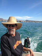


. So off we go! 4/22/2011
We left La Paz at one pm on the 21st. The channel was calm as it was an ebb tide. As usual the wind blew all morning and died as soon as we entered the bay. We motored to Puerto Ballena on Isla Espirito Santo and anchored in the south bite, which is named Ensenada La Gallina. We dropped the hook in 18 ft, with a sand bottom. Once settled in I dropped a line in and caught a couple of small bass and then a puffer fish. That was enough, I don’t care about catching something that wants to stick me with little poisonous spines. Besides we were tired and ready to crash. The boat performed admirably, no problems what so ever.
I arose at four am on the 22nd and proceeded to change the oil and check the gearboxes before we headed out. The night before we decided to make Isla San Francisco our next stop, as it would be an easy sail at only 24 nautical miles away. After breakfast we pulled anchor and got under way. This time we had a little wind, at least enough to furl out the jib to help the motor and save fuel. After about two hours the wind was up enough to kill the engine and run on the jib alone. Being such a short run, and since we had plenty of time, I didn’t hoist the main. Sailing downwind we made six knots in nine knots of apparent wind. The water was a bit choppy with four foot swells at about six seconds, but since it was a following sea it wasn’t bad at all. The temp in La Paz was supposed to be in the high nineties, but out on the water it felt more like the high seventies or low eighties.
Somewhere on approaching the anchorage at Isla San Francisco there is a dangerous rock that is not visible. We have three guide books and they all place this rock at different points. Basically this means that you can take your pick, or try to avoid all three locations. However, if none of them agree, maybe they are all wrong. There could one, two, or even three rocks lurking beneath the surface just waiting to rip a hole in the bottom of your boat. Maybe they are all the same, but they used different charts. The Mexico charts aren’t known for their accuracy. This certainly doesn’t instill any confidence upon approaching this anchorage. That is unless you have forward looking sonar, like the one we just installed in La Paz. We just approached at a slow speed and kept a keen eye on the sonar screen, no problem! We anchored in twenty two feet of beautiful turquoise water with a white sand bottom. The water is also bordered by a white sand beach that is loaded with puka shells. Somehow I thought they were from Hawaii not Mexico. Judy and I ran the dinghy to shore and walked across a sand spit that separates the beaches. It was low tide so Judy explored the tide pools, marveling at the sea life and the numerous whole sea shells of many varieties. Back home the beach comers have to search hard to find any good shells, but not here!
I did take some photos but will have to wait until we reach Puerto Escondido to post them. Today we will not go far. We are now on a sightseeing tour of the Islands and anchorages around this area. We will only make about fourteen miles total today. Ending up at Punta San Evaristo, via Punta Salinas, on Isla San Jose. It has an abandoned salt mining operation with abandoned vehicles and buildings Judy said she wants to explore
Subscribe to:
Post Comments (Atom)

No comments:
Post a Comment